Walk Derbyshire – Along the Great Nortner & Bonnie Prince Charlies Trails
This short walk skirts the rapidly expanding western boundary of Derby enjoying some of the fine surrounding countryside, and returns by way of the Bonnie Prince Charlie Walk. The Great Northern Railway was once a cross country line from Grantham to Stafford by way of Nottingham, effectively linking both east and west coast mainlines. It passed through Derby to the north of the city centre, crossing Friar Gate (Ashbourne road), on a magnificently decorated wrought iron bridge: it still exists and its listed status ensures its preservation. Apart from the trail, the bridge (now a two-starred listed monument), is the only nearby link with what must have been an extremely useful railway. Another subsequently useful link with the history of this line is the recently restored Bennerley Viaduct, a uniquely constructed listed and stared building – a rarity in this country, it is made from latticework wrought-iron, crossing the Erewash Valley, as well as its canals and also the Nottingham/Sheffield branch of the Midland Railway, in one huge high level swoop. With the restoration of Bennerley Viaduct, much of the central section of the Great Northern has been open to pedestrian and cycle traffic, albeit the bit beyond the viaduct unfortunately is buried beneath housing estates. What the Bennerley Viaduct does, however, is act as a link between two canal tow paths, thereby making an excellent walk through a long gone industrial area. For a longer walk, the section beyond Mickleover takes some beating; this walk follows part of the Mickleover section before wandering off through Derby’s Green Belt to follow part of the Bonnie Prince Charlie’s Way. Suffering the fate of the Beeching Axe, the line was decreed to be uneconomical, but rather than submit meekly its demise was slow and long drawn out. Officially the line was closed to freight on 7th September 1964, but until the 4th September 1967 it continued to operate carrying passengers only. Even then it had its uses when the Mickleover to Willington section was used as a test track for experimental rolling stock. The station at Mickleover is still there, but fulfilling a completely new existence as a private house and with the name of the Great Northern Railway immortalised by the one-time station pub on the main road. Starting from the small car park beside the Mackworth to Mickleover road opposite the Great Northern pub, the walk follows the converted railway for about a mile before branching out along paths to the North West, meandering over the fields leading towards Radbourne. A walk along a short rural lane wandering away from the village forges links with part of the Bonnie Prince Charlie Walk. This path is abandoned where it abuts a field track, which in turn is then followed all the way back to the railway trail. Here a left turn is made to return to the car park. THE WALK – STEP BY STEP From the car park follow the surfaced lane down to the site of the old station and join the trail. The remains of the old Mickleover station have been converted into private houses, but it nowadays turns its back on what was once the station platform. You can still see traces of siding where coal deliveries for the local district and goods were offloaded. The trail which here runs as far as Etwall is as proclaimed by the blue cast iron signpost to be part of Route 54, within the national cycle network. Walkers and cyclists can enjoy the safety of the track away from the danger of motorised traffic. Interesting art-work beside the bridge next to the last house gives a few facts and figures appertaining to the Trans-Pennine Cycleway, that runs, as the information on the nearby five-barred gate, for 350miles between Derby and Berwick on Tweed. Follow the trail for a little over a mile and look out for a footpath sign on your right. Leave the trail and drop down to and then cross a narrow stream. Climb up through rough woodland and out into open fields. Follow the right-hand edge of woodland before crossing four crop growing fields. Go through two gates on either sides of the minor road in order to enter a small wood. Leave the wood by going through a kissing gate and then bear slightly left and uphill. Aim for a wooden pole. It marks the route and on reaching it start to walk gently downhill, bearing right on a faint grassy path. This section of the route is along the right of way through Radbourne Hall Park, traditional home of the Pole family, at least since the late 18th century when the brick-built hall was erected. In 1781 the hall was the home of Erasmus Darwin, father of Charles whose theories delved into the origins and development of life on earth. Bonnie Prince Charlie is said to have spent a night at Radbourne Hall on his abortive march south. The village sprawls in a layout the medieval inhabitants would easily recognise, possibly finding it easier than modern visitors who frequently complain about getting lost when attempting to find the church. Incidentally it is probably easier to find when following this walk, as it lies in plain sight a matter of four or five yards from the footpath from Mickleover. Cross a small bridge and then aim for St Andrew’s church. Go through the little cast iron gate on your right and walk past the church, keeping the bell tower to your right. If the church is open it is well worth a visit, if only to admire the medieval tombs. Here lies Sir John Chambers, friend of Edward the Black Prince in the 14th century. Many of the Pole family intermarried with the Chandos family and later were laid to rest within the nave. Here is the effigy of Peter de la Pole who died in 1432 and is shown lying alongside his wife Elizabeth. He has long straight hair and holds a sword marked
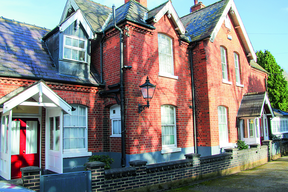
Walk Derbyshire – A Winter Warmer Around the Longshaw Estate

I have to make an apology before embarking on the text for this walk. In July I acquired a new hip, this was after upwards of ten years trying to ignore an ever growing problem. Fortunately I had the sense to build up a stock-pile of walks, which kept Garry and Alistair happy at Images HQ, making it possible for them to publish my walks as and when necessary. Feeling a lot better since my session with Mr Williams, one of the osteopath surgeons on the staff at Calow Hospital where, I must add, I didn’t feel a thing, and was much entertained by what sounded like the opening bars of Giuseppe Verdi’s Anvil Chorus from his opera il Travatore! Deciding it was time to put my boots on again, I chose this walk mainly because it is short and finishes with the alternative of a pub lunch or the excellent soup and sandwiches on offer at the National Trust tea-room next to Longshaw Lodge. Using easy to follow paths through what was once a sporting estate, the walk drops down into the upper valley of Burbage Brook. Here it joins one of the ancient Pack-horse tracks that once linked Sheffield to the salt wells of Cheshire, and carried finished metal goods such as scythes on the return trip. With far reaching views throughout, the walk starts by skirting the front of the lodge, along a path between it and the open moors now grazed by sheep, but once the realm of sportsmen and their guns in search of game. Going through a swing gate, the path splits with one going south towards Big Moor, and the other bearing right, drops down to the Grindleford road. This is the one we took, going past an attractive pond, the haunt of wild geese. The path crosses the road by way of a stone stile and then finds its way down to Burbage Brook. An ancient stone packhorse bridge crosses the brook which is followed upstream to another stone bridge. Here a right turn joins a cobbled track winding its way up to the Grindleford road again. Diagonally right across the road there is a gate house and behind it a footpath through woodland back to the car park. Longshaw Estate and its lodge was built in the early 1800s for the Duke of Rutland as a sporting estate. During the Great War of 1914-1918 it became a military hospital, mainly for Commonwealth soldiers. From old photographs it looks as though many of the fitter soldiers managed to enjoy the heavy snowfalls that seem to have been more regular then than now. In the 1920s Longshaw was bought by Sheffield Corporation as an amenity for the city whose boundary cuts through part of the estate. While the lodge has been turned into private residences, the rest of the estate having been gifted to the National Trust, is open to all. The now famous Longshaw Sheepdog Trials take place annually in the large field below the main house. The Walk : From the National Trust car park, follow the path down to the National Trust tea-room and Information Centre. Bear right and then left on to the path running between the lodge surrounds and open fields. Follow this path up to a swing gate next to wild rhododendrons. To your left as you walk along the first path, the raised wall apparently supporting the ground above it is called a ‘ha, ha’, or ‘haw, haw’. Its purpose is to prevent stock from encroaching the built-up area surrounding the lodge, but without spoiling the extensive moorland view. Reaching the gate, go through it, bearing right alongside rhododendron bushes, where pheasants are often sheltering. Wooden signs at the side of the path point to where children might find places where friendly boggarts live. Continue along this path until it reaches a large pond. Skirt round the pond with it on your right and then bear left past the second stone barn before you reach the road. It usefully serves as a shelter in wet weather, as well as offering information about the surrounding countryside and its wildlife. Cross the road and go through a stone stile and then drop down to a stone pack-horse bridge over the narrow brook. Cross the bridge and turn right, upstream for about a quarter of a mile, as far as the next bridge. Turn right and cross the narrow bridge. Follow a cobbled path, winding steeply uphill and through woodland as far as the road Go diagonally across the road, heading towards a gate house. Follow signs past the gate house and onto a woodland track. Continue along the track back to the National Trust car park Useful Information : 3miles (5km) of easy walking on well-maintained estate paths and riverside and woodland tracks. Recommended map: as the walk cuts through the northern and southern edges of both the OS White Peak (Sheet OL24) and OS Dark Peak (Sheet OL1) maps, it can make map oriented navigation rather difficult, but hopefully my poor quality sketch map and written instructions will be sufficient. Public transport: Regular service between Sheffield and Grindleford stop at the Fox House Inn a few yards from the entrance to Longshaw Estate. Parking: Inside estate (National Trust members free). Refreshments: Fox House Inn and Longshaw tea-room and Information Centre. Annual sheep dog trials as advertised. Guided walks and seasonal children’s events throughout the year. +10
Walk Derbyshire – Foolow & Silly Dale

There are no records of any simpleton, either in Foolow or Silly Dale; both names come from Anglo Saxon English and have entirely different meanings than in today’s language. Foolow means multi-coloured hill, possibly a reference to nearby Eyam Edge. Silly is Old English for pretty, an apt description of this little-known dale, especially in late spring when the limestone-loving flowers are in full bloom. The walk starts and finishes in Foolow, a village of light grey limestone cottages, arguably the most picturesque in the Peak District National Park. There is a bay-windowed manor house and the Bull’s Head offers an excellent menu to satisfy the hunger of the hardiest walker. Until 1888 when the tiny limestone church dedicated to St Hugh was opened, church-goers congregated around the ancient stone cross and its pagan bull-ring standing next to the duck pond. Until 1932 when pipes were laid, water was a problem in this upland village. Before then villagers had to collect water from a well a little way along the Hucklow Edge road above the village. Cattle enjoyed the convenience of the attractive duck pond on the village green and in celebration of the gift of water, village wells have been dressed since 1983 on the Saturday prior to the last Sunday in August. Starting from Foolow the walk climbs up to Hucklow Edge before turning west and descending to the neighbouring village of Great Hucklow. This village, clustered around its pub, the Queen Anne, is really a group of five inter-linked hamlets where lead miners delving 600 feet beneath the ground, worked the riches of High Rake, following a series of inter-connected veins running north-westwards. Pack Horse teams once carried the ore together with Cheshire salt across the high limestone moorland, by trackways that can still be traced for miles. From 1938 until 1970, the playwright L du Garde Peach produced plays in the popular Playhouse theatre, based on an old barn in the village. Beyond Hucklow, the walk descends into Silly Dale and, on climbing out of it, crosses a series of green fields back to Foolow. Useful Information 3miles (5km) of easy walking along rural lanes, field paths and a flowery dale. Recommended map: Ordnance Survey 1:25000 scale Outdoor Leisure map The Peak District – White Peak Area Sheet 24. Refreshments: Bull’s Head (Foolow), Queen Anne (great Hucklow), pubs and cafes in Eyam. Public Transport: TM Travel 65 service from Sheffield and Calver Sough runs hourly Monday/Saturday and two hourly on Sunday. G&J Holmes/Hulleys 66 service between Buxton and Chesterfield runs two hourly from Chesterfield Monday/Saturday and three hourly on Sunday. Parking: roadside around Foolow village, but please do not block local access. The Walk : With your back to the duck pond in Foolow, take the road past the church and head towards Hucklow Edge. Follow this road for just under a mile. The old village well at the side of the road to your left is protected by a wall with a narrow stile to keep animals away from the one-time sole drinking water supply for Foolow, once a scarcity on these dry limestone uplands. Regrettably the water is now unfit for human consumption. Just before the road begins to climb steeply and bears right towards Hucklow Edge, turn left and cross a stone stile in order to follow a wall-side path. Gliders from the Gliding Club behind the edge can usually be seen soaring gracefully on the up-sweeping currents of air. Tree-lined hollows and rough ground uphill towards the edge indicate the position of abandoned lead-mining activity. Joining a narrow lane turn left and follow it until it reaches a side road. Turn left along the road, following it below a belt of trees. At the far end of the woods, turn left over a stile and follow waymarking arrows and splashes of paint down into the Grindlow section of Great Hucklow. Bear left along the village road and then fork right towards the main road. Cross the road diagonally left and right, then go to the left of a single bungalow. Follow the narrow, walled track, down into Silly Dale. Surface water has not flowed down Silly Dale for at least 10,000 years, when catastrophic floods marked the end of the last Ice Age. Flowers growing along the dale include white meadow saxifrage, purple cranesbill and spotted orchids. Turn left at the T-junction marking the dale end and cross over to the opposite side of the dale. Go to the left over a stile, and bear right and then half left, uphill. Following stiles cross nine increasingly narrow fields as you near the village, all the way back into Foolow, entering the village by going past the Manor House in order to reach the duck pond. Foolow is built around a wide village green with the highly photogenic duck pond as its centre point. A fourteenth-century cross and a bull-ring-stone are on the far side of the pond. Better still is the Bull’s Head pub a few yards further along the Eyam road to your right [wpgmza id=”37″] 00
Walk Derbyshire – Viator’s Bridge & The Dove Holes

This short walk can be fitted in with a trip exploring more of Dovedale or simply as a day out combined with lunch at one of the hospitable pubs in villages round and about the valley. It is over 300 years since Izaak Walton fished in the pure waters of the river Dove along with his impecunious friend Charles Cotton of Beresford Hall, near Hartington. Apart from light traffic along the short stretch of modern road through Milldale, the two friends would easily recognise this part of the dale. Dovedale and its famous trout stream have changed little since Walton and Cotton spent time along its banks, angling and philosophising. Walton referred to the Dove as being ‘The finest river that I ever saw and the fullest of fish’; a sentiment true even today. Many of the houses in this tiny hamlet are founded on dwellings that would have been standing in Walton and Cotton’s time. The village takes its name from two mills that once provided employment for people living there; remnants of both mills remain, still capable of taking power from the river. Lode Mill is higher up the valley; converted into a barn, it once ground and separated lead ore from the parent limestone. The mill closest to the village is Ochre Mill; powered by water from the leat which begins a few yards upstream of Viator’s Bridge, is also recognisable as a barn, but in its day it produced powder for making red lead paint. In his angling treatise The Compleat Angler, Izaak Walton refers to himself as ‘Viator’ (traveller), and addresses Cotton as ‘Piscator’. (angler). In the book Walton expresses amazement at the narrowness of the bridge which bears his nom-de-plume, ‘Viator’. The route followed by this walk follows the river downstream from Viator’s Bridge as far as the curious rock formation known as Dove Holes. A secluded dry dale to the left and a few yards prior to the holes, climbs up to Hanson Grange Farm where the walk joins an ancient packhorse way back down to Milldale. The Walk : From the car park walk down to the river and cross narrow Viator’s Bridge. Turn right to follow the riverside path for a little under a mile. The thin alkaline soil on the craggy valley sides, supports many semi-alpine plants such as thyme and dwarf cranesbill. Turn left at the finger post pointing to Alsop-en-le Dale and climb the tree-lined dry dale and go beneath the line of rocky crags known as The Nabs guarding the dale’s exit. Before turning left uphill, walk forwards for about 80yards to visit Dove Holes. These massive water-worn holes appear, at first glance to be the start of an extensive cave system but are, in fact only about 20ft (6m) deep. This is a good vantage point for views up and down the dale. Return to the finger post and turn right to re-join the described walk. Turn left though a stile at the dale head and follow a series of stiles leading to the right of Hanson Grange Farm. Join its exit lane about 100yds (91m) beyond the farm. Hanson Grange Farm. There were several extensive monastic sheep walks in the area, until the Dissolution. Hanson Grange was part of one. The farm house looks Jacobean, but is probably built on older foundations. At the end of the partly walled section of the farm lane, turn left as indicated by a signpost close to an underground reservoir. Follow the sign’s direction across a series of fields, downhill towards Milldale. Zigzag downhill on the ancient packhorse way back into Milldale. The George at nearby Alstonfield is a popular pub for travellers, either by car, on foot, riding or pedalling. The oldest relic in Alstonfield Church is the economically worded inscription on the double decker pulpit which states: ‘Be faithful and etc., and I will give thee a crown etc.’ No doubt the carpenter was in a hurry when he carved those words! Useful Information 2½miles (4km) of valley walking, with one steep climb through woodland beneath The Nabs. Level farm tracks followed by a narrow packhorse track back down to Milldale. Recommended map. Ordnance Survey 1:25,000 scale Outdoor Leisure Sheet 24; The White Peak Area. Car Park. About a quarter mile above the village, west along Hope Dale (free). Refreshments: a cottage in the centre of Milldale serves light refreshments over a half-door. Pubs in several nearby villages. [wpgmza id=”33″] 00